
Page 7 - 2022 Chester County Guide & CCCBI Membership Directory
P. 7
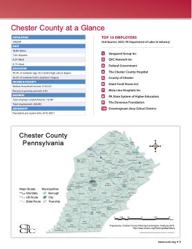
Chester County at a Glance
POPULATION
538,649
7.6% Hispanic
6.2% Black
6.1% Asian
EDUCATION
94.3% of residents (age 25+) hold a high school degree
Median household income: $104,161
Total employer establishments: 14,784
Population per square mile, 2010: 664.7
TOP 10 EMPLOYERS
(3rd Quarter, 2020, PA Department of Labor & Industry)
1 Vanguard Group Inc
2 QVC Network Inc
3 Federal Government
4 The Chester County Hospital 5 County of Chester
6 Giant Food Stores LLC
7 Main Line Hospitals Inc
8 PA State System of Higher Education 9 The Devereux Foundation
10 Downingtown Area School District
RACE
78.8% White
54.2% of residents hold a bachelor’s degree
INCOME & POVERTY
Persons in poverty, percent: 5.2%
BUSINESS
Total employment: 260,642
GEOGRAPHY
Chester County
Chester County
Pennsylvania
Pennsylvania
£� West
Valley
West Goshen
Lower Oxford
Oxford
East Nottingham
£�1
West Grove
Avondale
New Garden
London Britain
30
Upper Oxford
Londonderry
Penn
New London
Elk
£�1 Kennett Kennett
£�322
§¨¦76 £�202
Goshen
Westtown Thornbury
Elverson
West Nantmeal
West Vincent
East Phoenixville Pikeland
Schuylkill Charlestown
West £�322 Brandywine East
Uwchlan East
East Whiteland
Franklin
Warwick
East Nantmeal
East Vincent
Spring City
Brandywine Caln £�30
West Bradford
Newlin
Malvern
East Marlborough
£�422 North
Coventry
South Coventry
East Coventry
2
Tredyffrin Easttown
Honey Honey Brook Brook
West Caln
Sadsbury Sadsbury Parkesburg
§¨¦76 Wallace
Upper Uwchlan
West Pikeland
West Whiteland
Square
322
Pocopson
West
£�30 East Willistown
Bypa ss £�30
Coatesville
South Coatesville Modena
Caln £�30 Downingtown
£�
Chester
East Bradford
Major Roads Municipalities Interstate Borough US Route City State Route Township
West Nottingham
Atglen
West Fallowfield
Highland
East Fallowfield
West Marlborough
London Grove
£�202 Birmingham
Pennsbury
Prepared by: Chester County Planning Commission, February 2015 http://www chesco org/Planning/MapGallery
G:\deptdata\Planning\projects\mapgallery\GIS project files\muni_bas
0 2.25 4.5 9 13.5 18 Miles
Pr0epare2d.25by: C4h.5ester County9 Planning C1o3.m5 mission, F1e8bruary 2015 http://www.chesco.org/PlanningM/iMlesapGallery
emap.mxd
www.cccbi.org 5
