
Page 14 - Georgia Forestry - Winter 2020
P. 14
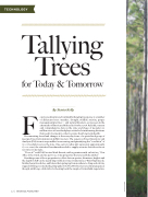
  TECHNOLOGY
 Tallying
Trees for Today & Tomorrow
  F By Stasia Kelly
orests are dynamic and continually changing in response to a number of different forces: weather, drought, wildlife activity, proper management practices — and natural disasters, as was seen in the aftermath of Hurricane Michael in October 2018. Reliable, current and comprehensive data on the state and shape of Georgia’s 22 million acres of forestland play a critical role in informing decisions that need to be made in order to ensure their long-term health.
Documenting forestland changes is the everyday focus of a specialized group of Georgia Forestry Commission (GFC) foresters. The 13-person Forest Inventory and Analysis (FIA) team is responsible for measuring and quantifying the “condition” of 6,000 land plots across the state. One 24-foot radius plot represents approximately 6,000 acres, the statistical benchmark needed to supply accurate data about forest resources in Georgia.
“I love it!” said FIA Forester Mark Barrett, with a genuine smile on his face. “Our office is the truck, and we get to see some properties that are really beautiful.”
Reaching some of those properties to collect data on species, diameters, heights and the depth of duff can be nearly impossible in some circumstances. Waist-high weeds, hidden hazardous holes, and briars that spring up from nowhere to cling and cut into rugged clothing, can make the going quite slow. The FIA foresters are always prepared, though, with long, solid sticks for beating back the tangle of formidable vegetation.
12 | GEORGIA FORESTRY
ALAN MOTHNER
